loader-image
20°C

ISLANTILLA - COASTAL PATH - LEPE

MTB/GRAVEL ROUTE

Ruta en bicicleta Islantilla Sendero Litoral Lepe
Icono azul de una señal de dirección que representa la distancia de la ruta.

Distance

24.20 km

Icono azul con un triángulo y una pendiente que representa la altitud o desnivel de la ruta en bicicleta.

Altitude

128m

Icono azul de una bicicleta que representa la dificultad del recorrido en bici.

Difficulty

EASY

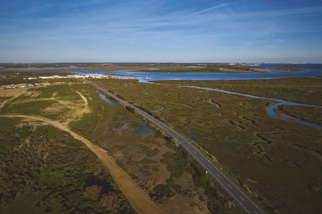
An easy mountain bike or gravel route starting in Islantilla and reaching Lepe via a simple and practical route. It includes a visit to Nueva Umbría Beach along the coast and the port of El Terrón, offering wonderful views of the Marismas del Río Piedras Natural Area and the Flecha de El Rompido sandbar.

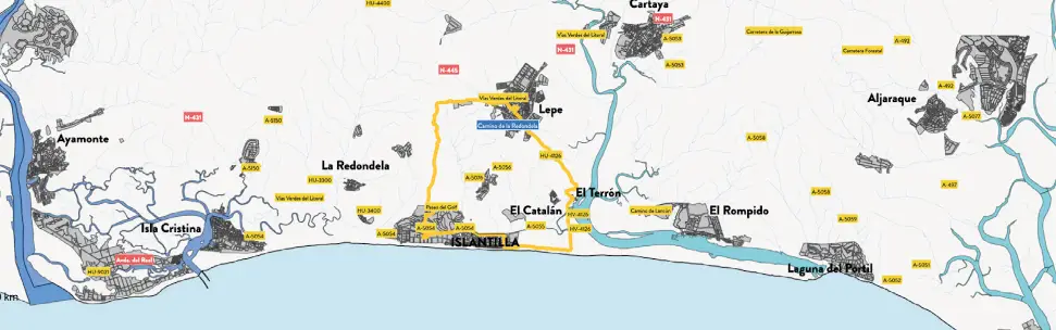
Ruta 5. Mapa de la ruta cicloturista desde Islantilla hasta Lepe por el sendero litoral de Huelva.
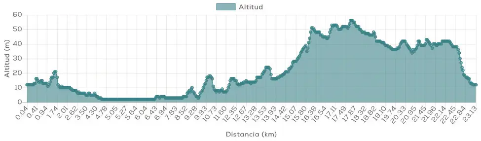
Ruta 5. Perfil de altitud de la ruta en bicicleta desde Islantilla hasta Lepe por el sendero litoral.

Islantilla - Coastal Trail - Lepe

MTB/GRAVEL ROUTE

Ruta 5. Mapa de la ruta cicloturista desde Islantilla hasta Lepe por el sendero litoral de Huelva.
Ruta 5. Perfil de altitud de la ruta en bicicleta desde Islantilla hasta Lepe por el sendero litoral.

The bike route Islantilla – Coastal Path – Lepe It's an ideal option for enjoying cycle touring in Huelva. without facing great distances or changes in elevation. With 24.20 km, 128 m of elevation gain and easy difficulty, this MTB and gravel route allows you to discover some of the most representative landscapes of the Islantilla and Lepe area.

A perfect outing for leisurely cycling and combining sport, coast and nature.

Route description

The tour begins in Islantilla and heads towards the municipal boundary of Lepe through a simple route, with little elevation change and no major technical difficulties.

As the route progresses, the urban landscape gives way to the natural environment of the coastline. One of its main attractions is precisely this. transition between different environmentsCoastal areas, natural paths and spaces linked to the marshes and the mouth of the river Río Piedras.

His slightly more than 24 kilometers This makes it one of the most accessible MTB and gravel routes from Islantilla, especially interesting for those who prefer short routes or want to get started in this type of cycling.

Distance: 24.20km

Altitude: 128m

Difficulty: easy

Route description

The tour begins in Islantilla and heads towards the municipal boundary of Lepe through a simple route, with little elevation change and no major technical difficulties.

As the route progresses, the urban landscape gives way to the natural environment of the coastline. One of its main attractions is precisely this. transition between different environmentsCoastal areas, natural paths and spaces linked to the marshes and the mouth of the river Río Piedras.

His slightly more than 24 kilometers This makes it one of the most accessible MTB and gravel routes from Islantilla, especially interesting for those who prefer short routes or want to get started in this type of cycling.

Distance:
24.20km

Altitude:
128m

Difficulty:
easy

DISCOVER THE TRIPLE DESTINATION ON TWO WHEELS

What makes this route special?

This route stands out for offering a lot of scenery in a relatively short distance. slight difference in level and easy difficulty They allow you to focus more on enjoying the surroundings than on physical exertion.

Código QR que enlaza a la ruta cicloturista Islantilla – Lepe por el sendero litoral en la web de Cycling Friendly.

Technical specifications of the cycling route

This road route has a total distance of 24.20 km and a cumulative elevation difference of 128 meters, which makes it a viable option easy difficulty.

Download GPX route and navigation

You can download the route track in GPX format and follow the route with your GPS device or cycling app. Additionally, you can access complete information via the QR code. Cycling Friendly.

Discover more bike routes from Islantilla

If you are interested in cycle tourism in Huelva, from Islantilla you can access numerous routes adapted to all levels:

👉 Islantilla – El Rompido

👉 Islantilla – Greenway – Ayamonte

👉 Islantilla – Isla Cristina

Discover more bike routes from Islantilla

If you are interested in cycle tourism in Huelva, from Islantilla you can access numerous routes adapted to all levels:

👉 Islantilla – El Rompido

👉 Islantilla – Greenway – Ayamonte

👉 Islantilla – Isla Cristina