loader-image
26°C

ISLANTILLA - GREENWAY - AYAMONTE

MTB/GRAVEL ROUTE

Ruta en bicicleta Islantilla - Vía Verde - Ayamonte
Icono azul de una señal de dirección que representa la distancia de la ruta.

Distance

18.51 km

Icono azul con un triángulo y una pendiente que representa la altitud o desnivel de la ruta en bicicleta.

Altitude

39m

Icono azul de una bicicleta que representa la dificultad del recorrido en bici.

Difficulty

EASY

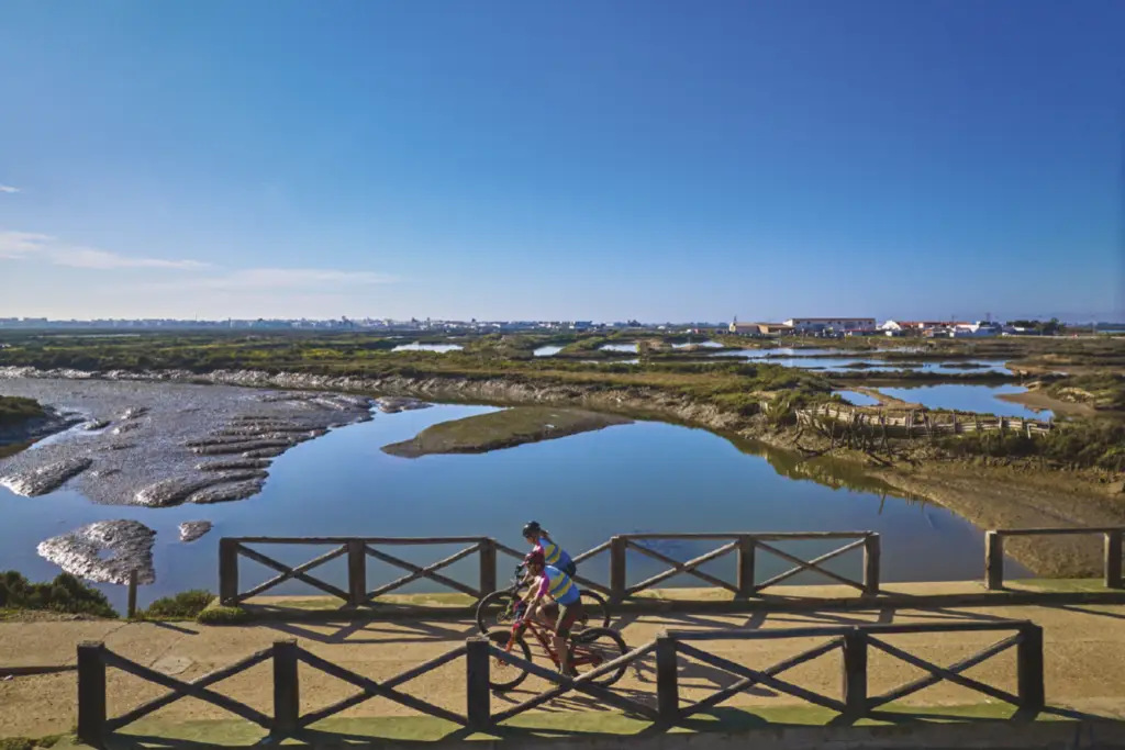
A mountain bike or gravel route starting from the Islantilla Commonwealth and ending in Ayamonte. This is a completely flat and peaceful ride along the Huelva Coastal Greenway, which runs through the Isla Cristina Marshes via La Redondela and Pozo del Camino, offering views of this Natural Area and a diverse array of birdlife.

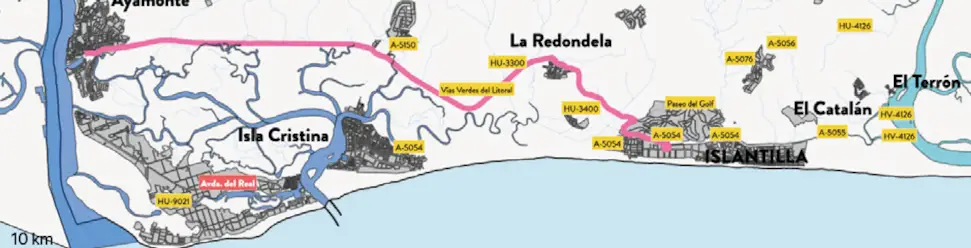
Ruta 9. Mapa de la ruta cicloturista desde Islantilla a Ayamonte por la Vía Verde.
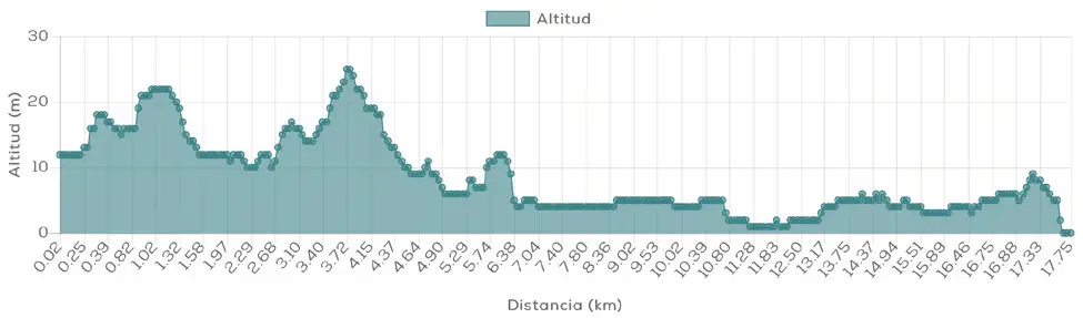
Ruta 9. Perfil de altitud de la ruta cicloturista Islantilla – Ayamonte por la Vía Verde.

Islantilla - Greenway - Ayamonte

MTB/GRAVEL ROUTE

Ruta 9. Mapa de la ruta cicloturista desde Islantilla a Ayamonte por la Vía Verde.
Ruta 9. Perfil de altitud de la ruta cicloturista Islantilla – Ayamonte por la Vía Verde.

The bike route Islantilla – Greenway – Ayamonte is one of the most affordable options Enjoy cycling in Huelva. At only 18.51 km long, with 39 m of elevation gain and an easy difficulty level, it offers a peaceful and practically flat route. from Islantilla to Ayamonte.

Nature, birdlife and a very gentle profile make this route an excellent choice.

Route description

The route starts from the Commonwealth of Islantilla and heads towards Ayamonte. Unlike other MTB and gravel routes from Islantilla that are longer and have more elevation gain, this route stands out precisely for its simplicity.

Along the route, sections of the Huelva Coastal Greenway, a route that allows you to discover the territory at a leisurely pace and enjoy the scenery surrounding the cyclist.

The route passes through the surroundings of La Redondela and Pozo del Camino before continuing towards Ayamonte. The minimal elevation change makes it easy to maintain a comfortable pace for almost the entire route, allowing the scenery to be the true star.

Distance: 18.51km

Altitude: 39m

Difficulty: easy

Route description

The route starts from the Commonwealth of Islantilla and heads towards Ayamonte. Unlike other MTB and gravel routes from Islantilla that are longer and have more elevation gain, this route stands out precisely for its simplicity.

Along the route, sections of the Huelva Coastal Greenway, a route that allows you to discover the territory at a leisurely pace and enjoy the scenery surrounding the cyclist.

The route passes through the surroundings of La Redondela and Pozo del Camino before continuing towards Ayamonte. The minimal elevation change makes it easy to maintain a comfortable pace for almost the entire route, allowing the scenery to be the true star.

Distance:
18.51km

Altitude:
39m

Difficulty:
easy

DISCOVER THE TRIPLE DESTINATION ON TWO WHEELS

What makes this route special?

Its combination of short distance, minimal elevation gain, and natural scenery makes this one of the most accessible routes in Islantilla. It's a particularly attractive option for those who want to enjoy gravel riding in a relaxed way or are looking for a short ride during their vacation.

Qr009

Technical specifications of the cycling route

This road route has a total distance of 18.51 km and a cumulative elevation difference of 39 meters, which makes it a viable option easy difficulty.

Download GPX route and navigation

You can download the route track in GPX format and follow the route with your GPS device or cycling app. Additionally, you can access complete information via the QR code. Cycling Friendly.

DISCOVER THE TRIPLE DESTINATION ON TWO WHEELS

What makes this route special?

The combination of distance, rural roads, pine forests and river landscapes makes this route a very comprehensive proposal For experienced cyclists. It also allows you to connect several of the most interesting spots around Islantilla in a single ride.

Qr009

Technical specifications of the cycling route

This road route has a total distance of 18.51 km and a cumulative elevation difference of 39 meters, which makes it a viable option easy difficulty.

Download GPX route and navigation

You can download the route track in GPX format and follow the route with your GPS device or cycling app. Additionally, you can access complete information via the QR code. Cycling Friendly.

Discover more bike routes from Islantilla

If you are interested in cycle tourism in Huelva, from Islantilla you can access numerous routes adapted to all levels:

👉 Islantilla – El Rompido

👉 Islantilla – Piedras River

👉 Islantilla – San Silvestre

Discover more bike routes from Islantilla

If you are interested in cycle tourism in Huelva, from Islantilla you can access numerous routes adapted to all levels:

👉 Islantilla – El Rompido

👉 Islantilla – Piedras River

👉 Islantilla – San Silvestre