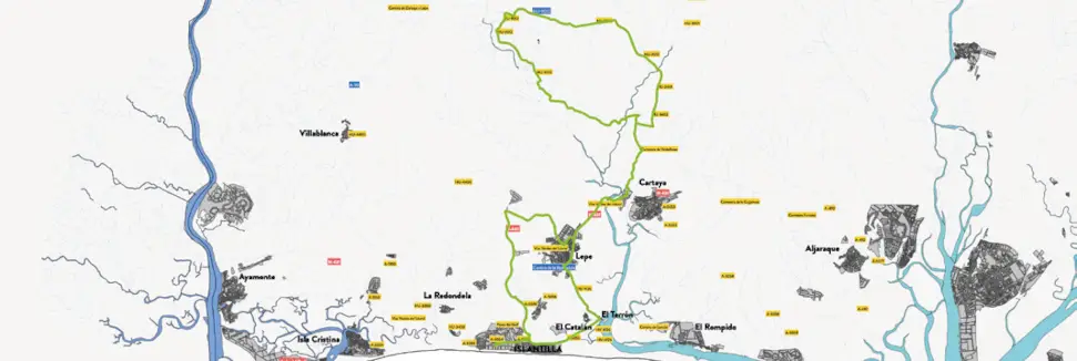
The route starts from Islantilla and heads inland, passing through municipalities such as Lepe and Cartaya, two key locations on the Huelva coast. Along the route, the cyclist enters an environment that combines extensive pine forests, cultivated fields and paths that reflect the essence of the Huelva landscape.
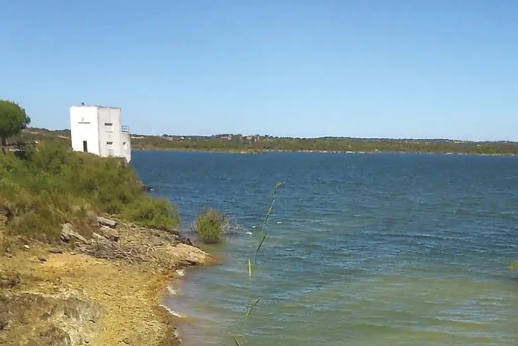
The final destination is the Piedras River Reservoir, This infrastructure, built in 1968, covers approximately 800 hectares and supplies a large part of the province's western coast. This enclave offers a valuable natural environment, ideal for enjoying a break before heading back.
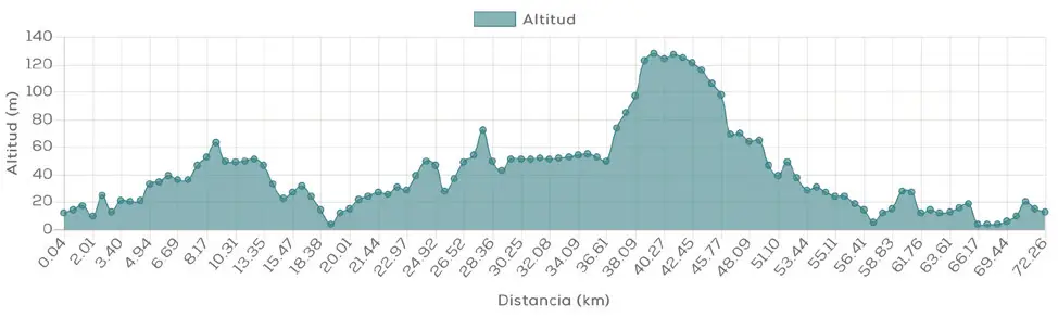
With a distance of 70.70 km, this route is Perfect for those who practice road cycling in Huelva and they wish to take a long, complete tour with varied scenery.