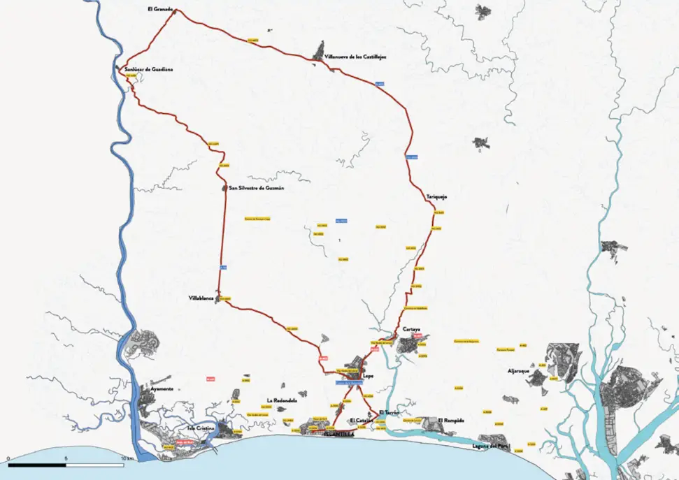
The route starts from Islantilla and advances towards the interior of the province, passing through various municipalities along the coast and the Andévalo of Huelva. As you leave the coast, the landscape gradually changes, leaving behind the pine forests and marshes to give way to more winding roads, gentle slopes and rural environments characteristic of the interior of Huelva.
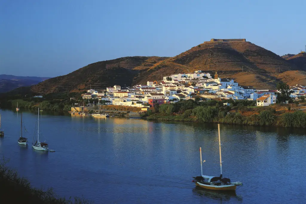
The main protagonist of the tour is Sanlúcar de Guadiana, one of the most picturesque villages in the province. Located next to the Guadiana River and opposite the Portuguese town of Alcoutim, this enclave offers spectacular views of the natural border between Spain and Portugal.
Reaching this point means enjoying one of the most complete road routes in Huelva, combining long distances, accumulated elevation gain and very varied landscapes that make each section a different experience.