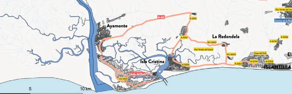
The route starts from Islantilla and advances westward, skirting the Huelva coastline until it enters the natural environment of the Isla Cristina Marshes. Throughout the route, the cyclist passes through various municipalities and coastal towns such as Isla Cristina, Pozo del Camino, Ayamonte, Isla Canela, Punta del Moral and La Redondela, discovering the close relationship between the sea, the marshes and the fishing tradition of this area of Huelva.
The itinerary stands out for its comfort and for the variety of landscapes It offers: quiet roads, views of the Atlantic, salt flats, tidal channels and wide natural areas where water and vegetation form an ecosystem of enormous environmental value.
One of the most special points of the route is located in Punta del Moral, from where you can contemplate the Carreras Estuary with Isla Cristina in the background, offering one of the most characteristic panoramic views of the Huelva coastline.