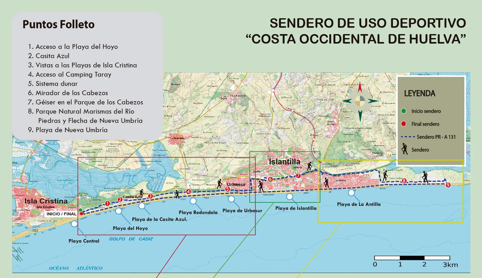
Trail access
The trail is located in a privileged environment on the western coast of the province of Huelva, in the southwest of the Andalusian region and on the Costa de la Luz. Access to the beginning of the trail is located in the Pinar de Isla Cristina, on Playa Central Levante. During the first kilometers, the path runs parallel to the road that connects Islantilla with Isla Cristina, so there are numerous possibilities to access it. Finally, the return is from Nueva Umbría beach.
TECHNICAL DATA:
Route: Circular
Length: 25.5km
Time: 7 hours, 16 minutes
Elevation +: 247m
Unevenness -: 59m
Land: Compact sand, track and cement
Difficulty: 2
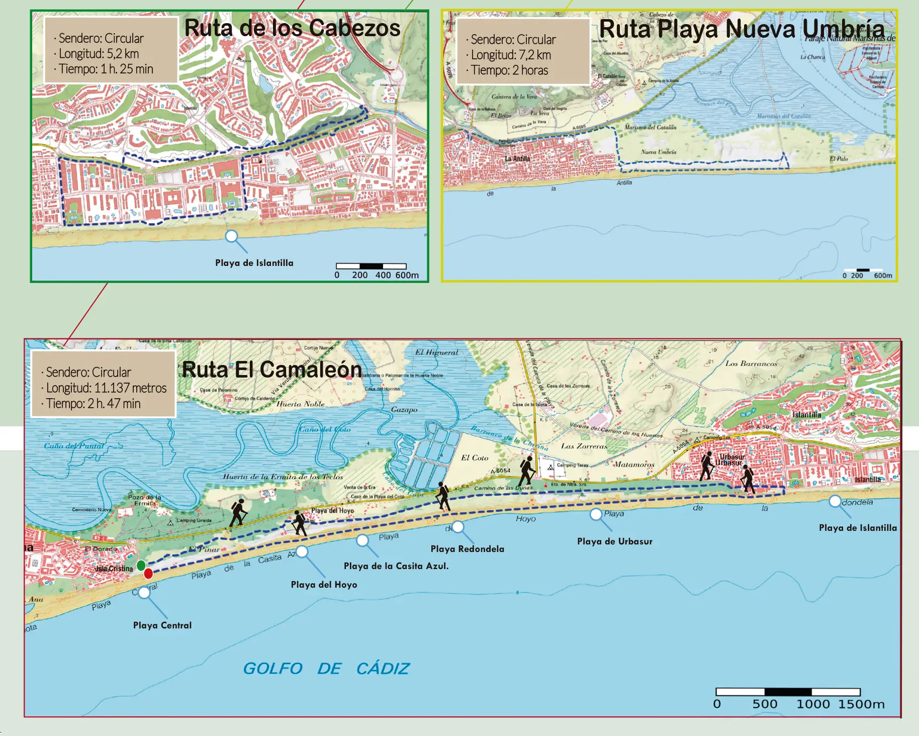
It is a circular path that has great biological diversity despite running between Isla Cristina and the urban centers of Urbasur, Islantilla and La Antilla. There are three clearly marked circuits along its layout. The first part runs through a dune environment until reaching the urban area of Paseo de Poniente, in Islantilla; The second starts from there to the easternmost end of the Parque de los Cabezos; and the third begins at the exit of this park until reaching the virgin beach of Nueva Umbría, near Puerto del Terrón. At each of these points there are information panels indicating the possibility of doing these sections separately.
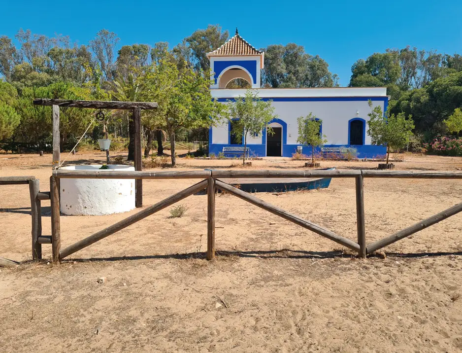
The complete path is called 'Sendero Costa Occidental de Huelva', and begins in the Pinar de Isla Cristina next to the access to the Central Levante Beach along a concrete path until reaching the Casita Azul environmental and tourist revitalization space, which has a point visitor service where tourist information is offered.
The route continues through the Dunes of Isla Cristina and among stone pines that provide plenty of shade, making the walk pleasant even if the journey takes place during the summer months. It is an extremely fragile environment, so extreme care must be taken to avoid its degradation. The end of this section is marked by the eucalyptus trees that flanked the old merchant route between Isla Cristina and La Antilla.
You can still see some remains of clay that formed the road. The route runs parallel to the beach at all times, and in some areas the sand is looser, which can make us slow down. You reach the urban area by passing through Paseo de Poniente, in Islantilla, seeking, after crossing some pedestrian crossings, to reach the climb to Parque de los Cabezos.
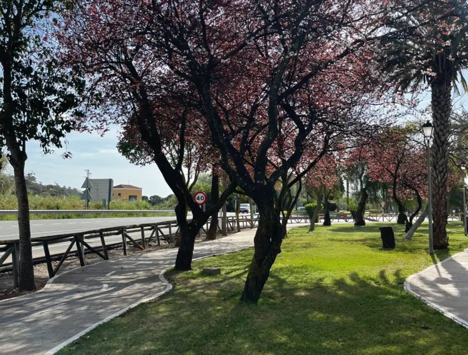
This park has a circuit of about 3 kilometers prepared exclusively for walking and playing sports. Go up and down through a place with Mediterranean vegetation and fauna where, in addition to enjoying the colors, smells and shapes offered by the flora and fauna present in this space, we can contemplate the intense blue-green of the sea in the distance. You will be surprised by the beautiful viewpoint over the sea and an artificial lake with a large geyser.
The exit from the park connects with another urban section in La Antilla that crosses a passage with trees, and subsequently crosses an open area without developments that is relatively recent in which there are currently still small trees planted. At the end of the concrete section we reach a coastal path parallel to Santa Pura beach that is well delimited by wooden railings and runs behind the dunes. This path has loose sand in some sections.
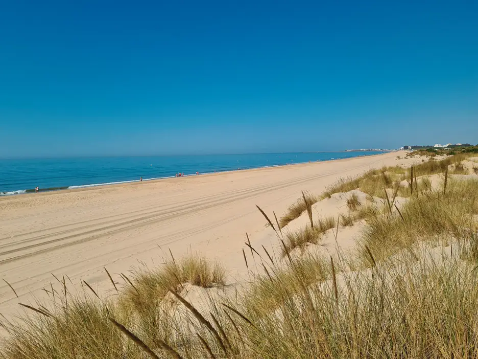
Once we reach the virgin beach of Nueva Umbría, we return along an extensive beach of fine, golden sand more than 90 meters wide that, even during the months of July and August, receives a low influx of visitors. The most advisable thing is to walk along the shore where the sand will be more compacted. During the return journey there are multiple walkways that allow you to leave the beach at any time. Thus, from Nueva Umbría Beach we will cross La Antilla, Islantilla, Urbasur, La Redondela, Casita Azul and Playa del Hoyo, until we reach Central Beach again, from which we will return to the starting point in the Pinar de Isla Cristina.